REVIEW · BARCELONA
Barcelona Urban Planning Tour – Towards a Sustainable Smart City
Book on Viator →Operated by Nostos Tours · Bookable on Viator
A smart city is easiest to see on foot. This Barcelona Urban Planning Tour maps the city’s big sustainability bets—then shows how they look in real neighborhoods. You’ll connect old-town streets to newer planning moves like superblocks and a traffic-reduced axis, all with an expert guide and a focused route that takes about 2 to 4 hours.
I especially like the way the tour explains cause and effect: what planners changed, and how that affects daily life. I also like that the stops are spread across Barcelona’s eras, from Rambla del Raval to the 22@ Innovation District in Glòries, so you get a clear “how we got here” storyline. You’ll come away with a sharper eye for what the city is trying to fix.
One thing to consider: a bicycle is not included, and if you want an eBike you’ll need to rent it separately through the RideMovie app. If you’re hoping for a smooth, fully handled bike experience, plan for that extra step.
In This Review
- Key things you’ll notice on this Barcelona smart-city walk
- From Raval to 22@, you get planning you can actually see
- Price and logistics: what you’re paying for (and what you’re not)
- The route rundown: a smart-city story in four stops
- Stop 1: Rambla del Raval and the historic logic of the old town
- Stop 2: Sant Antoni and what a superblock really changes
- Stop 3: Eixample’s Consell de Cent, where traffic gets the plan
- Stop 4: Glòries and the 22@ Innovation District (from industry to startups)
- Walking pace, group setup, and the smart-city vibe
- Walking vs. eBike: how to choose without getting stuck
- Why this tour changes the way you see Barcelona
- Who should book this Barcelona Urban Planning Tour?
- Should you book it? My practical decision guide
- FAQ
- How long is the Barcelona Urban Planning Tour?
- What neighborhoods are included?
- Is this tour walking only?
- What language is the tour offered in?
- Where does the tour start and end?
- How much does it cost?
- Are admission tickets included for the stops?
- Is the tour private?
- What is the cancellation policy?
Key things you’ll notice on this Barcelona smart-city walk
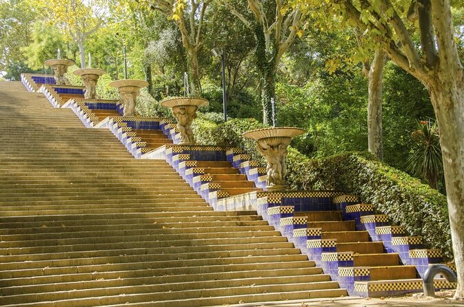
- Superblocks in Sant Antoni explained as more than a design buzzword—how they change street life
- Eixample’s traffic-reduced route via Consell de Cent, where mobility meets planning
- Raval’s old-town context helps you understand why Barcelona’s grid and streets evolved the way they did
- 22@ in Glòries shows the shift from industrial area to innovation district
- An expert guide keeps the big ideas grounded in what you can actually see on the sidewalk
From Raval to 22@, you get planning you can actually see
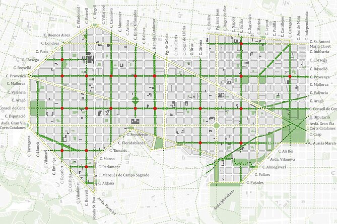
Barcelona has plenty of stunning architecture. This tour adds something else: the city’s rulebook. Not in a boring, government-pdf way. More like, you look at a street and the guide helps you read the decisions behind it—traffic choices, neighborhood redesign, and where Barcelona is steering growth.
The title says sustainable smart city, but don’t expect sci-fi gadgets. The “smart” part shows up in practical moves: calming traffic, rethinking how blocks function, and repurposing older industrial zones. That’s the kind of sustainability that changes what your day feels like—where you can walk, where cars dominate, and how space is shared.
And the route has a nice rhythm. You start in Ciutat Vella near the Rambla del Raval, then work your way through neighborhoods that represent different stages of Barcelona’s planning. The endpoint lands in Sant Martí, at El Parc i la Llacuna del Poblenou—close to where the city’s newer mindset is easy to spot.
You can also read our reviews of more tours and experiences in Barcelona.


Price and logistics: what you’re paying for (and what you’re not)
At $210.28 per person, this isn’t a bargain-basement walking tour. But you are paying for a guided lens on city planning—plus a private setup where it’s only your group. In other words, you’re not just taking photos and moving on. You’re getting an organized explanation of how Barcelona is trying to become more livable and sustainable, and you’re doing it in a tight time window of roughly 2 to 4 hours.
A few details help you judge value:
- The tour focuses on planning concepts at several real-world sites, so you’re buying interpretation, not just movement.
- The tour includes an expert guide, which matters here because the topic can get abstract fast.
- “Admission ticket free” is listed for each stop, so you’re not paying extra entry fees to see the neighborhood planning features.
What you don’t get is transportation help beyond what you bring yourself. The information clearly says bicycle use is not included. If you want an eBike, that’s an added cost and you’ll handle it through RideMovie.
The route rundown: a smart-city story in four stops
This tour is built around four short, timed stops. Each one helps you understand a different layer of Barcelona: old street logic, neighborhood redesign, street-level traffic strategy, and the shift from industry to innovation.
Stop 1: Rambla del Raval and the historic logic of the old town
You begin near El Gato de Botero on Rambla del Raval in Ciutat Vella. This is a strong opening because it frames the city before the “modern solutions” start showing up. In this area, the guide spends about 20 minutes talking about the historic situation—how the old town developed, and why today’s planning conversations can’t be separated from that past.
This stop is useful even if you’re not a hardcore urban-planning person. Why? Because it teaches you to look at streets as outcomes of time, not random layout. You start noticing the difference between what a street is now and what it was built for.
Possible drawback: because this is about context, some of the storytelling may feel more conceptual before the tour turns practical at the later stops.
Stop 2: Sant Antoni and what a superblock really changes
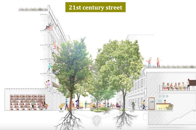
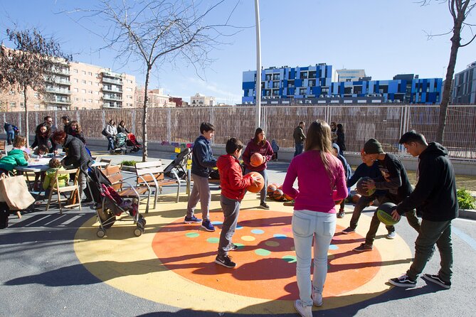
Next is Sant Antoni, with about 15 minutes here focused on the idea of a superblock. This is one of the most talked-about tools in Barcelona’s sustainability toolkit, but the real test is whether it improves daily life. The guide’s job is to connect the concept to what you can see and what you can imagine changing: street priority, pedestrian space, and the balance between cars and people.
In plain terms, you should leave this stop with a clearer mental picture of why Barcelona treats blocks as units for redesign rather than just building-to-building upgrades. If you’ve ever wondered why one corner feels calmer than another, this is the type of explanation that makes the city click.
Stop 3: Eixample’s Consell de Cent, where traffic gets the plan
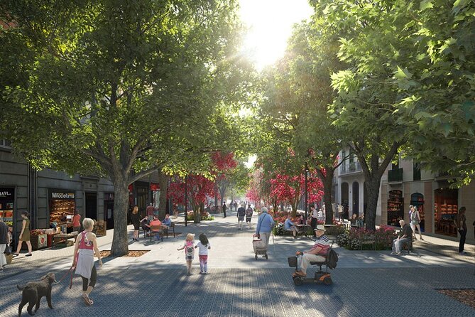
Then you head into Eixample, for about 30 minutes around Consell de Cent, described as a newly traffic reduced/free axis. This is where the tour gets especially tangible. “Traffic reduction” can sound like politics. On this street, it’s the kind of planning decision you can sense right away because it changes how the space functions.
Eixample is all about order—an urban structure that makes it easier to model what happens when traffic is redirected or softened. So the guide can point to how Barcelona is applying rules to movement, not just to buildings. You’ll likely find yourself looking down the street and thinking about the trade-offs: convenience versus speed, car access versus walkability, and how a city decides what gets prioritized.
Tip for you: slow down during this part and pay attention to what feels easier on foot. The tour’s value is in connecting design to that lived experience.
Stop 4: Glòries and the 22@ Innovation District (from industry to startups)
Finally, you reach Glòries and the 22@ district, focused on about 30 minutes. The theme here is transformation: a former industrial zone now used for the innovation district model.
This stop helps you zoom out. Sustainability isn’t only street redesign. It also includes what you build, where you build, and how you repurpose land. In 22@, the guide connects the dots between an older economy and newer growth in tech and innovation spaces.
If you like seeing cities reinvent themselves without wiping the slate clean, this stop is a strong capstone. It turns the tour from “how to manage today’s traffic” into “how to shape the city’s next chapter.”
Walking pace, group setup, and the smart-city vibe
The tour runs 2 to 4 hours. The exact pace will depend on your group and how much the guide lets you ask, but the route is organized with short stop times that keep it moving. The stops are timed at roughly 20 minutes, 15 minutes, 30 minutes, and 30 minutes, which is a good sign: you’re not stuck at one lecture point for an hour.
This experience is also listed as private, meaning only your group participates. That’s a quiet advantage for a topic like this. When planning gets technical, a private group format makes it easier to ask questions and get answers tailored to your curiosity level.
In reviews, guides are praised for clarity and for making the topic feel personal. Names that came up include Onno, who was described as a great guide and someone who made city planning and government feel understandable, and Yannis, who was noted as friendly and considerate in a bike-related version of the experience. Even if you don’t rent an eBike, those kinds of guide qualities matter because urban planning stories can otherwise turn into chalkboard explanations.
Walking vs. eBike: how to choose without getting stuck
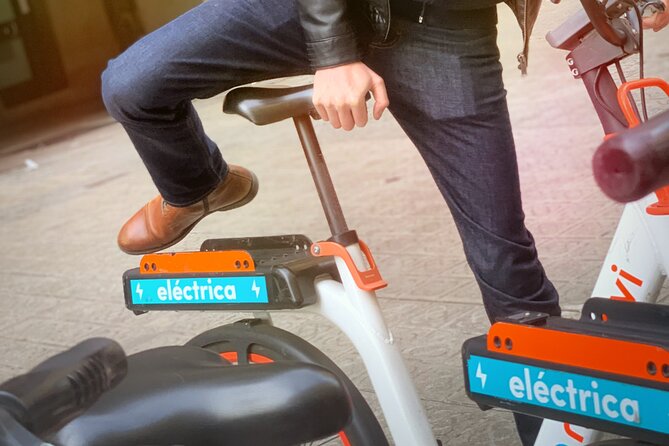
The information is clear: bicycle use is not included. If you want to add an eBike, you’ll pay separately and rent it through the RideMovie app.
Here’s how to decide:
- Choose eBike if you want to reduce leg fatigue and keep your attention on the commentary rather than managing distance.
- Skip it if you’re comfortable walking and you want the full “street-level” feel of each stop.
Either way, the tour’s concept works best when you’re actively looking at street space—crossings, block shapes, and how cars and pedestrians share room. A bike can help you cover distance, but the learning comes from paying attention while you move.
Why this tour changes the way you see Barcelona
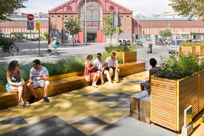
The best part isn’t just that you learn terms like superblock or innovation district. It’s that you learn how planning choices shape daily life. The tour’s structure pushes you to think in cause-and-effect.
You start with the old town context in Rambla del Raval. Then you move to a neighborhood redesign idea in Sant Antoni. Next comes a street-level traffic strategy in Eixample. Then you end with a land-use transformation story in 22@.
That sequence matters because it makes sustainability feel practical. Instead of thinking Barcelona is “green” as a brand, you learn how the city is making decisions to be more livable—through space management, movement design, and development direction.
It also helps you travel smarter afterward. When you’re back on your own, you’re more likely to notice:
- where the city gives pedestrians room
- where traffic feels controlled versus prioritized
- where redevelopment is changing neighborhood identity
- how older areas influence what’s possible next
That’s a real value-add, especially if you plan to spend several days in Barcelona.
Who should book this Barcelona Urban Planning Tour?
Book it if you:
- like understanding how cities work, not only what they look like
- want sustainability explained through real spaces (superblocks, traffic reduction, redevelopment)
- enjoy neighborhood contrasts—old-town logic to modern innovation districts
- prefer guided interpretation that keeps a clear route and timeline
You might skip it if you’re after a classic art-and-monument day. This tour is about urban planning. The “main attractions” are the neighborhoods and the street-level systems behind them.
Should you book it? My practical decision guide
If you’re curious about the logic behind Barcelona’s changes—and you want a guide to connect the dots—you’ll probably love this. The strongest reasons to book are the topic clarity and the way the stops build into a coherent story from historic beginnings to future-focused planning. The superblocks and traffic-reduced street segment are the kind of ideas that can either stay abstract or click fast, depending on how they’re explained. Reviews give confidence that the guide work lands well, including mention of Onno and Yannis.
If you want a fully managed transportation package (for example, a tour that includes bikes), this one has a small mismatch. Bicycle use isn’t included, and eBike rental is handled separately via RideMovie. If that’s not your plan, you’re fine—you can still get the value from the walk and the commentary.
If you decide to go, I’d treat it as your “how Barcelona works” day. Fit it early enough in your trip that it can change what you notice on the rest of your days.
FAQ
How long is the Barcelona Urban Planning Tour?
The tour lasts about 2 to 4 hours.
What neighborhoods are included?
You’ll visit Rambla del Raval, Sant Antoni, Eixample (around Consell de Cent), and Glòries in the 22@ district.
Is this tour walking only?
Bicycle use is not included. If you want an eBike, it must be rented and paid through the RideMovie application.
What language is the tour offered in?
It is offered in English.
Where does the tour start and end?
Start: El Gato de Botero, Rambla del Raval, s/n, Ciutat Vella, 08001 Barcelona, Spain. End: El Parc i la Llacuna del Poblenou, Sant Martí, Barcelona.
How much does it cost?
The price is $210.28 per person.
Are admission tickets included for the stops?
The stops are listed as ticket free.
Is the tour private?
Yes. It is a private tour/activity, so only your group participates.
What is the cancellation policy?
Free cancellation is available. You can cancel up to 24 hours in advance for a full refund.